
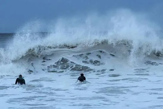
Meteorologists in the United States are warning that a slow-moving coastal storm is forming off the country's East Coast, with forecasts pointing to several days of strong winds, coastal flooding and beach erosion. The system, known as a nor'easter, is expected to linger offshore for much of the week, gradually pushing up waves and water levels along a long stretch of shoreline.
The hardest-hit area is expected to run from North Carolina northward to New Jersey, according to the warnings. The US Weather Prediction Center said the nor'easter formed off the North Carolina coast. While heavy rain is not expected to be the main danger, the storm's slow pace and its effect on tides are the central concerns for forecasters and coastal communities.
Storm forms off North Carolina
The US Weather Prediction Center reported that the nor'easter took shape off the coast of North Carolina. Such storms are common along the US East Coast, where cold air from the north meets warmer air over the Atlantic, but this system is notable for how slowly it is expected to move.
Forecasters say the storm should stay offshore for most of the week. Even so, its prolonged presence is expected to raise waves and water levels along the coast, with risks intensifying especially during high tide periods.
The storm's track and the timing of its departure from the coast remain uncertain, according to the warnings. Experts are also watching whether the system gains subtropical characteristics next week, which could change its behaviour.
Coastal flood warnings issued
Coastal flood warnings were issued for parts of Maryland, Virginia and northeastern North Carolina. The most exposed states include North Carolina, Virginia, Delaware and New Jersey, where low-lying areas could see water rise about 60 centimetres above ground.
Wind gusts may exceed 72 kilometres per hour, adding to the risk of beach erosion and damage along the shoreline. The combination of elevated water levels and strong winds is expected to persist over several days rather than pass quickly.
Heavy rain is not expected to be the main danger. Most precipitation should stay over the sea, away from land, meaning the primary threats are linked to water pushed ashore by wind and tide rather than rainfall.
Slow pace raises concern
The slow movement of the storm is a key factor in the warnings. Because the system is expected to remain offshore for much of the week, each high tide brings a renewed risk of flooding in vulnerable coastal areas.
Forecasters stress that the risks intensify especially during high tide periods, when water levels are already elevated. Residents in exposed areas may face repeated rounds of flooding rather than a single event.
The uncertainty over the storm's track and departure time means the duration of the threat is not yet clear. Experts continue to monitor whether the system gains subtropical characteristics next week, which could affect its strength and path.
What it means for the Gulf
For residents and businesses in the Gulf, the storm is a distant weather event, but it carries lessons about how slow-moving coastal systems can disrupt daily life. The US East Coast warnings highlight the kind of prolonged flooding and wind damage that can affect low-lying shorelines, a concern familiar to many communities around the Arabian Gulf.
Although the nor'easter is not expected to affect the Gulf directly, such events often influence global travel and shipping schedules. Coastal flooding and strong winds can disrupt airports, ports and road networks, with knock-on effects for freight and passengers travelling between regions.
The warnings also underline the importance of monitoring tide times and official forecasts during severe weather. For Gulf residents with family, property or business interests along the US East Coast, the coming week may bring delays and localised flooding, and checking updates from local authorities is advised.